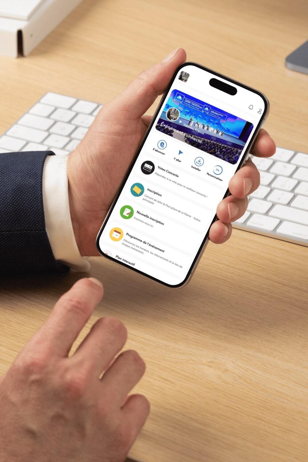
How do I create an interactive map for my event?
To create an interactive event map for your event, simply use a map design tool provided by a map company. In just minutes, you can easily add and customize content by clicking and dragging elements onto the map. For example, you can add exhibitors, conferences, speakers lists, news, images, videos, and more.
ents over the course of days. Don't forget to include options for users to click and share the map, making it easy for them to spread the word about your event through text and other communication methods.
How can the interactive map assist people in getting ready for a festival?
The interactive map, with its efficient management of festival events, makes it easy for people to take action and get started with their festival planning. They can explore the open maps to get an overview of the event, zoom in on specific areas, and click on exhibitors and attractions to visit their information pages. By using the map, attendees can strategically plan their day at the festival in just minutes. This user-friendly tool takes place as an essential part of any well-organized event, ensuring a smooth experience for all visitors.
Can I easily share my event's interactive map with others?
Yes, sharing your event's interactive map is easy. Simply click on the "Share" button and choose the method of distribution (e.g., email, social media, etc.). You can also track the results of your sharing actions to see how many people are engaging with your map, making map management more effective.
What types of content can be integrated into the interactive map to organize a festival?
The interactive map allows you to easily add various types of content to help organize your festival event. You can include exhibitors, conferences, speakers lists, news, images, videos, and more. For example, you can also use the maps to prepare a running schedule for each day of the festival, ensuring everything takes place smoothly.
How do participants access the interactive map during the festival?
Participants can access the event's interactive map by visiting the festival website or using a dedicated app. The map will be open and available for them to use throughout the day, enabling them to swiftly locate information, navigate the festival grounds, and make the most of their time at the event. This ease of use enhances the overall festival experience and helps attendees explore all the available attractions and events taking place.
How can I customize the design of my event's interactive map to suit my festival's unique needs?
Customizing your event's interactive map is easy with the map design tools provided. You can add lines to delimit spaces, set up objects, and even use text to label different areas. With a few clicks, you can build an interactive map that reflects the unique setting and atmosphere of your festival event. These custom maps will assist your participants in better navigating the event and having an enjoyable experience.
How can interactive maps enhance the overall experience for festival-goers by offering a broad range of features at an event?
Interactive maps can enhance the festival event experience by making it easy for people to find their way around the map, locate specific attractions or exhibitors, and plan their day efficiently.
With features like zoom, search filters, and real-time updates, interactive maps create a user-friendly experience that helps participants make the most of their time at the festival event. These maps not only enhance value to your event but also ensure that your attendees have a memorable time exploring all that your festival has to offer.
Is it possible to integrate sponsors and partners into the interactive map?
Yes, it is possible to integrate sponsors and partners.
With careful organization and management of the work, you can include these elements at different stages of the process. They can be presented at a conference, in a list, in an article, or on dedicated media, highlighting their contribution to the project. The interactive plan template can be adapted to include partner logos and ideas, integrating them seamlessly into the overall event. The launch of these partnerships can be done at the event venue, for example by offering dedicated spaces or by setting up virtual booths.
Integrating sponsors and partners into the plan strengthens the foundation of the project and provides added value to the events, while ensuring a rewarding experience for everyone.
Can I automatically include my exhibitors on the map with their descriptions?
Absolutely, we automatically import your data to avoid double entry.
Is it possible to manage the budget of an event with the interactive map?
It is quite possible to manage the budget of an event with the interactive map by taking into consideration a list of things such as objectives, investors and audience expectations. The system provides tools to facilitate the creation, organization and monitoring of the budget at each stage of the planning process. Budget management is an integral part of Imagina's functionality, allowing organizers to control expenses and track costs associated with every mission and every stage. Financial details can be integrated into a specific document, accessible and editable by team members.
Can there be floors to my plan?
We integrate the different levels into your interactive map for a perfect representation of your event. There are no floor limits. We can also create basements according to your needs.
Does the interactive event map facilitate the creation of an event communication plan?
The map facilitates the creation of an effective communication plan for a successful event by allowing for quick updating of information, provides pre-made templates for easy design, ensures effective message delivery and allows for easy management of a contact list for targeted communication. In addition, it allows organizers to manage key elements of the communication process, such as audience participation, deadlines, social networks, marketing actions and milestones. The platform helps to define communication objectives taking into account the expected participation. It also facilitates the timeline planning stage to ensure that each marketing and communication action is executed on time. With the clear and interactive visualization of the communication plan, organizers can quickly identify key actions and action items, track their progress, and adjust strategies as needed.
It allows for quick updating of information, provides pre-built templates for easy design, ensures efficient message delivery, and makes it easy to manage a contact list for targeted communication
How is data security and privacy of event information ensured?
Imagina ensures data security and confidentiality of event information by using encryption protocols to protect data, by implementing strict access control for users, by performing regular updates to prevent vulnerabilities and by performing backups to ensure data recovery if needed. In addition, Imagina has a clear and transparent privacy policy, detailing how data is collected, used and protected, so email, messages, lists, templates and other items are protected. The platform also complies with current data protection regulations, such as the RGPD.